Weathering Heights: India Launches INSAT-3D Meteorological Satellite
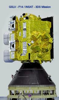
On July 26, 2013, India’s dedicated meteorological satellite INSAT-3D was successfully launched into a Geosynchronous Transfer Orbit (GTO) by Ariane-5 VA-214 launch vehicle from Kourou, French Guiana. This satellite has been designed and developed by the India Space Research Organization (ISRO). The orbit-raising process of manoeuvres is underway to place it in the 36,000 km high Geostationary Orbit. Even though the satellite was launched by a French rocket, it is also important to note that after initial injection into the transfer orbit (GTO) by the French rocket, the satellite itself performs further manoeuvring to reach the Geostationary Orbit. The satellite’s propulsion system is being used for this purpose. The satellite carried more than 1000 kg of propellant to conduct this orbit-raising activity. Finally, the satellite would be placed at 82 deg East orbital slot and is expected to become operational within a week after the launch.
India already has two operational meteorological satellites (MetSats) called KALPANA and INSAT-3A in space. They are providing cloud imagery in various categories. INSAT-3D offers a significant improvement over these predecessors. It gives far better cloud imagery regarding weather phenomena like low clouds and fog, which are usually difficult to judge using normal satellite imagery. This new satellite would also provide an accurate sea surface temperature (SST) estimation. These inputs are essential for various purposes, such as the forecasting of monsoons, the forecasting of tropical cyclones and the utility for the fishery industry because the presence of fish in a particular portion of the sea depends on the temperature conductions at sea.
The INSAT-3D is expected to add a new dimension to weather monitoring through its Atmospheric Sounding System, which provides vertical profiles of temperature (40 levels from surface to ~ 70 km), humidity (21 levels from surface to ~ 15 km) and integrated ozone from surface to top of the atmosphere. The satellite also has a data relay transponder onboard, which collects weather observations from automatic weather stations located in inaccessible areas such as deserts, mountains, and water bodies. Meanwhile, the IMD and ISRO have already established over 1,800 data collection platforms in various remote places in India. Another key payload of this system is the search and rescue unit, which will pick up distress beacons from users on land, sea and in air during emergencies. India’s neighbours and islands in the Indian Ocean region could also benefit from this system.
INSAT-3D is an advanced weather satellite configured with an improved imaging System and Atmospheric Sounder. India, being an agricultural economy, is dependent significantly on weather conditions. Weather inputs play an essential role in forecasting and monitoring the progress of the Indian monsoon. India, being a peninsula, is regularly affected by tropical cyclonic storms, particularly during the summer and early winter periods. The weather department is significantly dependent on satellite imagery for this purpose.
Regarding natural disasters, India could be viewed as a victim of its geography. The Himalayan mountain range, which is located in the northern and eastern parts of the country, is prone to earthquakes, landslides, flash floods, glacier lake outburst floods (GLOFs), Artificial Glacier Lake Outburst (AGLO) and glacier melting. In the recent past, India has witnessed devastating natural disasters like tsunamis, earthquakes, cyclones, floods, etc. Recently, the Uttarakhand region in northern India witnessed a major natural disaster. The flash floods following the heavy rains of 16-18 June 2013 forced the Indian government to launch one of the biggest relief and rescue operations in recent times. This disaster killed thousands, and an estimated 100,000 people were rescued by India’s security forces, civil rescue workers and disaster management agencies. The mammoth physical effort put up by these agencies was supported by appropriate weather nowcasting and short-range forecasting. This became possible due to various factors, including the actual inputs received from the disaster area about weather and topographic conductions, inputs received from radars and satellites and usage of Geographical Information Systems (GIS) tools.
Over the last few years, India has merged as a new hub for investing in the global business sector. Multinational agencies are making increasing investments in various projects in India, including infrastructure projects. For the execution of these projects, timely and accurate weather inputs are essential. Water scarcity is rapidly becoming a cause of concern in various parts of India. For effective implementation of water resources management, meteorological inputs are essential. The tourism sector is another sector which is significantly dependent on climatic conditions. Particularly, the increase in aviation activity demands reliable and timely weather forecasts.
India and the subcontinent have already been witnessing severe climate change-induced disasters and erratic weather phenomena. To cope with climate change, including the above-mentioned requirements, the launch of weather satellites INSAT-3D should be viewed as a timely and much-needed step.